

2015 - 2016 Projects
Tanzania - Fellowship Program
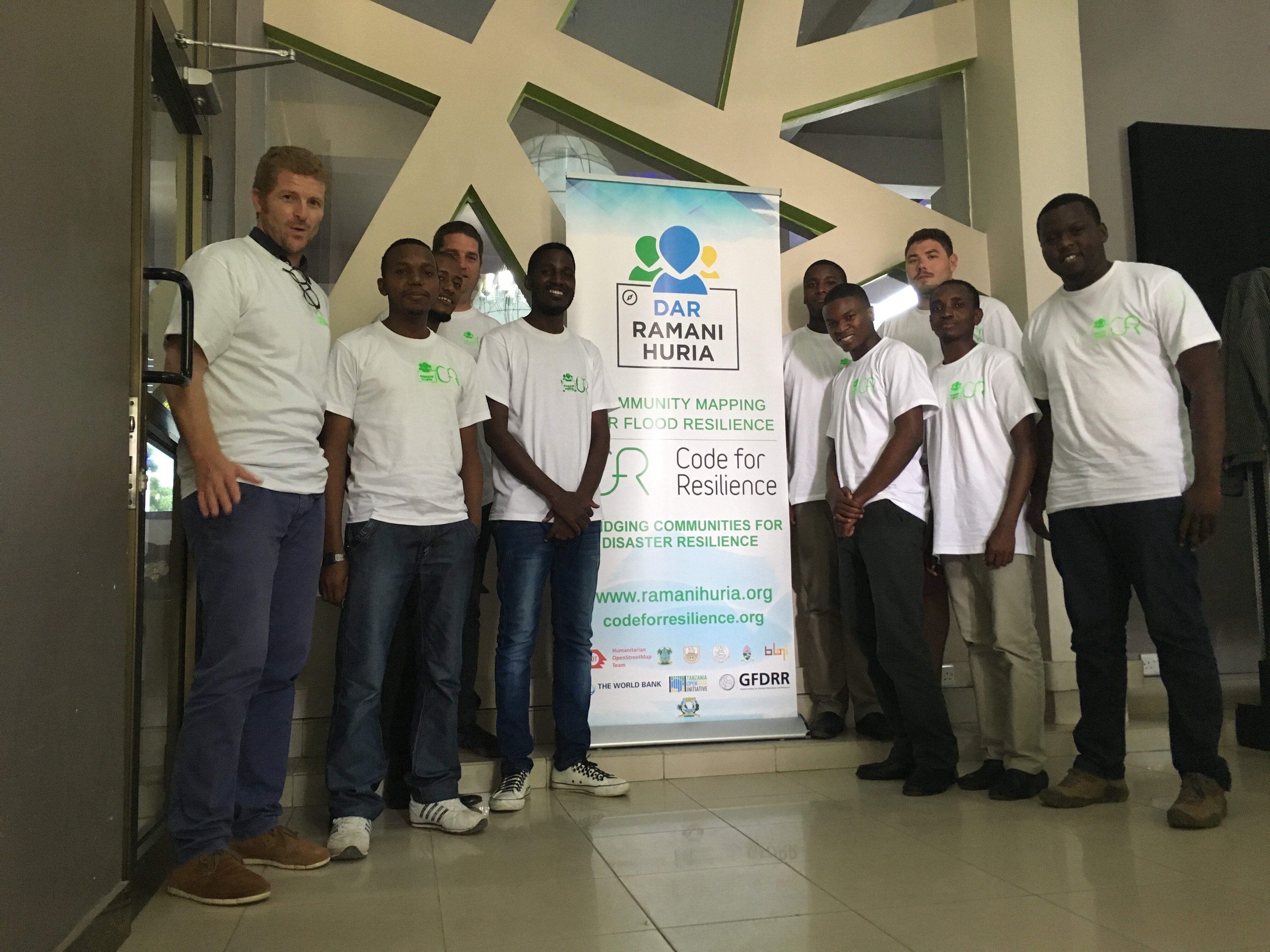
Code for Resilience (CfR) (https://codeforresilience.org) is a GFDRR project, aimed at connecting technologists and sector specialists to create technology to help reduce disaster risk. In Tanzania this is timely due to the Ramani Huria (http://ramanihuria.org) - Community mapping for flood resilience project. Raman Huria is a collaboration between Government of Tanzania’s Commission of Science and Technology, Dar es Salaam City Council, Red Cross and local universities coordinated by and World Bank, supporting the mapping and data collection across Dar es Salaam. Through Ramani Huria, flood prone neighbourhoods are being surveyed in collaboration with university students and community members, with the resulting maps providing a new tool for city and national government to plan resilience and response activities. But, this has also enabled existing technological gaps to be identified, which the projects of CfR and Ramani Huria can now address.
Ultimately, this led to five problem statements being developed and matched to six Code for Resilience fellows, drawn from across Tanzania and Zanzibar:
• Geonode and QGIS metadata integration in for ZanSea (http://zansea-geonode.org) and National Management of Environment Council (NMEC). ;
• InaSafe Flood inundation software feature enhancement for the Prime Minister’s Office - Disaster Management Department;
• Inasafe Population and elevation data curation, through integration of the http://worldpop.org.uk database;
• Design and localisation of Kiswahili of Adopt-a-Drain;
• Prototyping the implementation of low-cost 3D printed weather stations (rain, wind and flow gauges) in collaboration with the Tandale Ward Office and Kinondoni Municipal Council
The results and progress of the fellows and challenges will be shortly posted on the Ramani Huria blog: http://ramanihuria.org/news/ and on the Code for Resilience website (https://codeforresilience.org). Photos and media from the event are here:
There are now weekly checkins with the fellows, TODI and CfR team to monitor progress and to support fellows with mentorship. Mentorship is provided by a variety of technologists, from specialists at the Norwegian Environment Agency and GFDRR to the State University of Zanzibar.
Togo - FUNctional EStimation (FUNES) Model
In Togo, heavy flooding costs millions of West African CFA francs in losses and damages each year. Timely, simple, and accurate forecasts tools that collect, process, and disseminate data in a timely and reliable manner are key. Currently, however, the country lacks such information, as data management is completed manually and there is no platform to store it.
Code for Resilience (CfR) has partnered with the Red Cross Red Crescent Climate Centre (RCCC) to develop a hydrological model embedded in a digital platform to support early warning and early action in Togo’s Mono River Basin. This project aims to develop an SMS-based system for pluviometer data collection upstream and downstream of the dam, which will also support the establishment of a forecast-based financing project for disaster preparedness around the Nangbeto Dam on the Mono river basin.
Haiti - SMS Lapli
Haiti is highly exposed to multiple natural hazards and 96% of its population lives at risk. The 7.0 magnitude earthquake that hit Haiti in January 2010 killed up to 230,000 people, and caused an estimated US$8 billion in damages and losses.
The country’s economy is heavily dependent on the agricultural sector, which produces more than 25% of the national GDP and is the main source of revenue for rural households. However, only 1% of farmers use irrigation, and understanding rainfall is crucial for the vast majority of farmers to grow crops used as their primary source of food and income.
These farmers, and the country as a whole, are in need of a system that collects reliable hydrological and meteorological data. This information would be useful in facilitating the required coordination with national and local early warning systems to help protect lives and livelihoods.
To prepare for, and respond to, natural disasters the Haitian Government and Civil Society organizations must have the relevant data available for prompt assessments and response as well as for planning and preparedness. Much of Haiti’s disaster risk data, however, is available only in hard copy or distributed in PDF format. This makes it difficult for different government agencies, to produce, distribute, and use geospatial data analysis and other products in the timeframe needed to support rapid and effective decision-making.
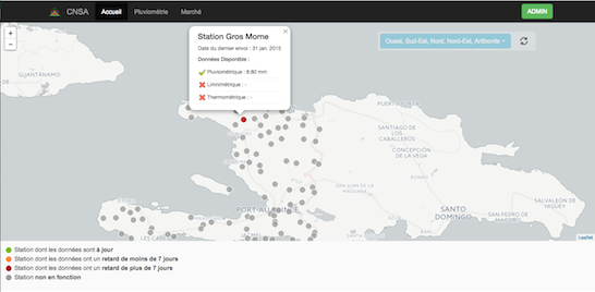
Building on the momentum established in 2014 through Konbit Teknolojik pou Rezilyans (Code for Resilience Haiti), this year, the program is working to reduce disaster risk through hydromet technology with SMS Lapli (which means “SMS rain” in Haitian Creole).
This open source application is just the first module of a national data platform allowing different hydromet networks in the country to work together. SMS Lapli will help the newly created Hydromet Unit at the Ministry of Agriculture to systematically collect, analyze, archive and disseminate rainfall data from more than 100 agro-meteorological stations across the country.
Through smart application of technology and strong partnerships between scientists, civil society groups, governments and development institutions, vulnerable communities can better protect lives and safeguard economic progress.
To find out more about the work in Haiti, make sure to follow us in Twitter, contact us, and see our feature story here
Stay tuned for updates on our projects in Tanzania, Sri Lanka, and Indonesia...
Messiah - Pakistan
In case of an accident or emergency, the Messiah app relays a distress signal by sending emergency alerts to a pre-identified network of family and friends at the push of a button. Recognizing that often times members of local communities are themselves the true “first responders,” Messiah enables “samaritans” within its community of users to help one another in times of emergency.
Please visit their website: http://www.messiahapp.com/
Jakarta InaSAFE - Indonesia
This prototype framework of DaLA tools modifies the existing Indonesia Scenarios Assessment for Emergencies (InaSAFE)* to integrate basic features with different systems used by Jakarta’s Natural Disaster Mitigation Agency (BPBD) and automate the creation of DaLA data to estimate direct damage and losses incurred by flooding in Jakarta. Further technical development of JakSAFE continues.
- InaSAFE is a free and open source software project that produces realistic natural hazard impact scenarios for better planning, preparedness and response activities.
Premium! - Haiti
Premium! is web application designed in Haiti to increase the availability of real-time information for decision-making by automating the processing and analysis of data in Haiti’s Emergency Operations Centers (EOC). The design required for the developers to add functionalities that would allow information to be collected and shared via text messaging, and use social networks to share time sensitive information with the public.
Nigechizu project (Community based evacuation mapping) - Japan
A project concept developed by young Japanese architects using their spare time, this app provides maps that include the path of past tsunamis and suggests safe locations for shelter in the event of a disaster. http://www.nigechizuproject.com/
Save the baby! - Japan
This application focuses on providing critical maternal, newborn and child health information in time- sensitive settings such as combating disease epidemics following major disasters, and using telephone lines to suit the communication environment in developing countries. http://mlabo.net/2014/09/5441/ Save the Baby went on to win the MIT Climate Lab Code Sprint, and currently being tested for implementation in the Philippines.
Daak (Call for help) - Dhaka
Unfortunately during the chaos that accompanies destructive natural disasters some see the opportunity to prey on the most vulnerable. And even though not as directly related to disaster risk management or water management, sexual harassment is a serious problem in Bangladesh.
Specially designed to prevent sexual harassment, Daak is a personal safety app that can be used online and offline. With the push of a button, Daak will convey your call for help (and location) to the nearest police station and pre-identified loved ones. The app coding is fully open source.
Daak is available for download in Google play: http://rupamit.com/home/daak.html
SOS - India
SOS is an RFID/GPS- based beaconing system that will enable disaster response officials to determine the density of tourist groups traveling along popular religious mountainous routes. When visitors arrive at the pilgrimage entry sites they register their mobile number and unique ID, and are assigned an RFID tag that can be registered by beacons placed periodically along tourism routes.
iLigtas - the Phillipines
iLigtas is a technology flexible, easy to use, cross-platform mobile application that prepares you for disaster, helps during disaster, and provides means for recovery after a disaster. The application collects data through crowdsourcing via SMS, geotagging, and social media feeds, and then creates infographics and provides relevant data to LGU’s and NGOs for a more disaster resilient Philippines. The application is available for download on Google play:
SIK Navigator – Hanoi
SIK Navigator is a navigator app to help people and ships in the Vietnam sea by locating and updating the status of ships in the area and directing them to support one another in emergency rescue missions.